DRONE SOLUTIONS
Advanced UAV Technology for Various Missions
Drone solutions for mapping, monitoring, and high-precision field operations.
High Precision
Long Endurance
Modular Payload
Autonomous Flight
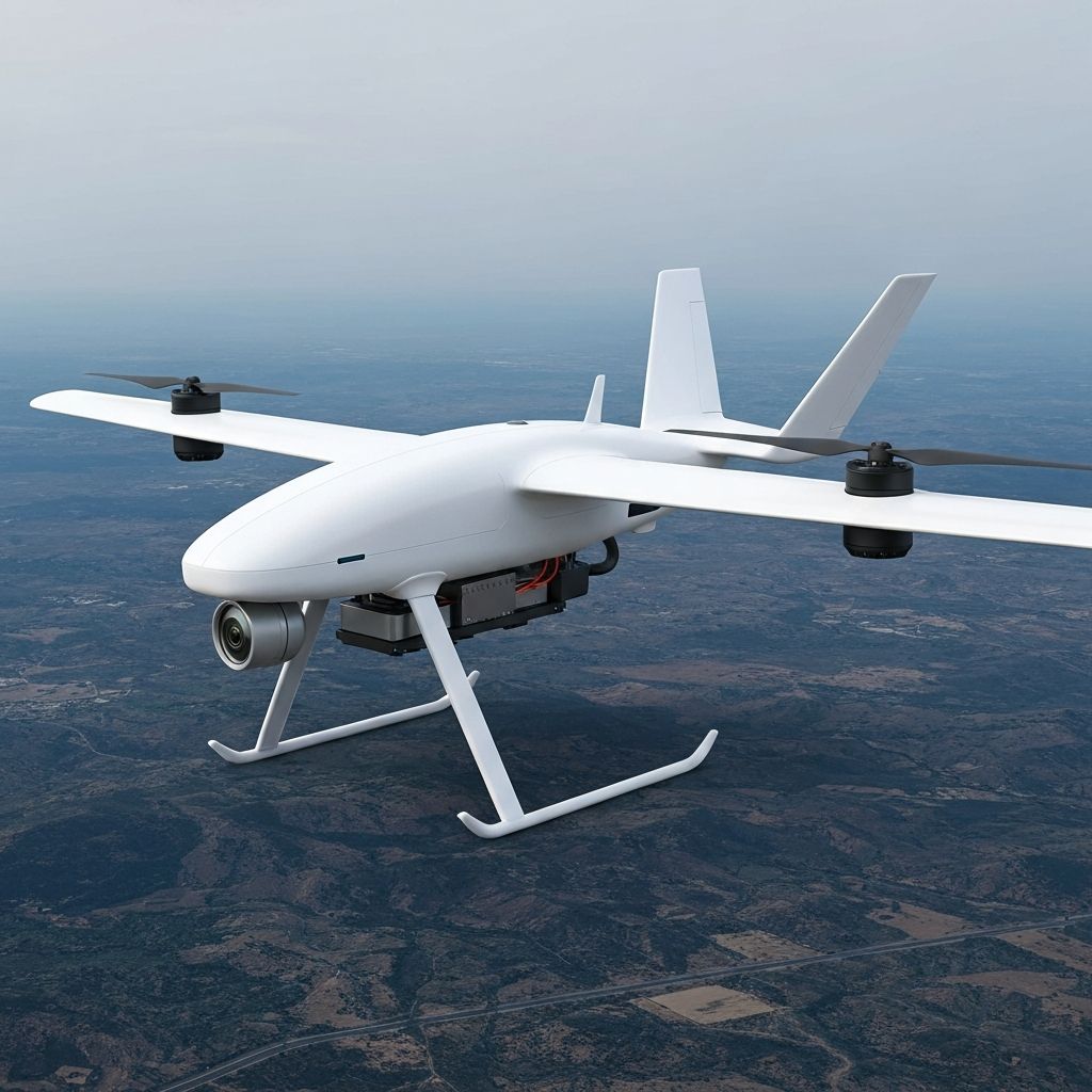
SENJA
Long-Range Mapping UAVSENJA is a next-generation mapping drone solution designed specifically to meet high-accuracy aerial survey needs.
Key Specifications
- Lightweight and sturdy composite body structure
- Large wingspan for long range
- Stable and retractable landing gear system
- High-efficiency electric motor
- Modern autopilot system
Surveillance Payload
Capable of carrying various surveillance and mapping payloads
Precision Flight Path
Responsive, easy to control automatically or manually
Easy Maintenance
Suitable for rapid operational deployment
User Friendly Software
Ground control support and data integration
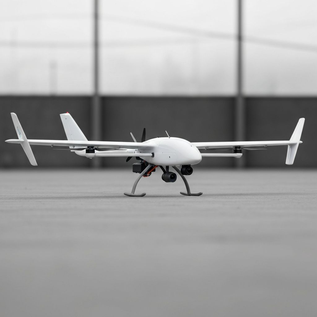
MUGIN
VTOL Hybrid UAVElectric-powered UAV with fixed-wing configuration and VTOL feature enabling vertical takeoff and landing.
Key Specifications
- Aerodynamic body with wide H-tail configuration wings
- Four rotors for VTOL action
- Sturdy structure from Fiber/Carbon composite
- Integrated navigation and autopilot control system
VTOL Flexibility
Fixed-wing efficiency in one device
Field Operations
Without runway infrastructure
Precision Navigation
Modern navigation system support
Industry Compatible
Suitable for industry and research